India braces for second hurricane-strength storm in 10 days
- 4 years ago

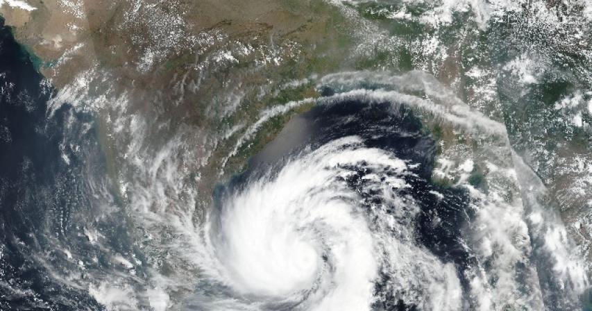
For the second time in 10 days, India is set to be slammed by a powerful cyclone, or a hurricane-equivalent storm, bringing the risk of damaging winds, storm surge and heavy inland rainfall. The system, known as Yaas, is only a tropical storm as it swirls over the Bay of Bengal. But it is expected to intensify into a high-end Category 1-strength tempest before its midweek landfall along India’s northeast coast.
The anticipated landfall comes just nine days after Gujarat, India, was slammed by the “extremely severe” cyclonic storm Tauktae, which made landfall last Monday Eastern time as a high-end Category 3-equivalent storm with 125-mph winds. Its landfall coincided with a report of the nation’s deadliest day of the covid-19 pandemic, with 4,329 deaths recorded.
At least 86 people were killed by the storm, which caused an estimated $2.1 billion in damage, according to RMSI, a global-catastrophe risk-management consultancy.
At 1130 IST, Cyclone ‘Yaas’ about 520 km south-southeast of Paradip. To intensify further and cross north Odisha-West Bengal coasts betweenParadip and Sagar Islands around Balasore, during noon of 26th Mayas a Very Severe Cyclonic Storm. pic.twitter.com/Xb9cHYsfyE
— India Meteorological Department (@Indiametdept) May 24, 2021
Now a new system is brewing, not in the Arabian Sea but rather to the east of India. Tropical Storm Yaas had winds of 40 mph early Monday Eastern time, making it a borderline tropical storm. But it is set to intensify steadily over the coming days, and it should wrap into a solid hurricane-strength cyclone by late Tuesday as landfall nears. It was located about 400 miles away from its imminent landfall location early Monday, moving north-northwest at about 4 mph.
The India Meteorological Department has hoisted rainfall and wind warnings for the states of Odisha and West Bengal. Local authorities have been working to ensure the safety of oxygen generation plants amid the covid-19 crisis.
Depression over the Bay of Bengal has intensified into cyclone Yaas. Discussed precaution & relief work with BJP State office bearers, MPs & MLAs of affected areas of West Bengal, Odisha, Sikkim, Andaman & Nicobar. Our Karykartas will provide all help following COVID protocols. pic.twitter.com/iyZzIXzjQP
— Jagat Prakash Nadda (@JPNadda) May 24, 2021
On satellite, the storm had a robust shield of cloud cover spiraling into it from the west, but bare ocean could be seen through gaps in low-level clouds east of the center. That’s usually a sign of dry air, but in this case, the environment surrounding Yaas is saturated, save for a narrow strip of dry air east of the storm at 30,000 feet. As such, it looks like Yaas’s lopsided appearance isn’t so much an indicator of obstacles impeding Yaas’s development as it is a symptom of the storm’s gradual maturation.
We pray for the safety of the people of states which are going to be affected by #CycloneYaas.
— Tripura Pradesh Youth Congress (@iyctripura) May 24, 2021
Everyone please keep your nerves calm & Emergency numbers issued by the state if needed.
Stay indoors. Stay Safe.
Take all the necessary precautions. #CycloneYaasUPDATE pic.twitter.com/vXV7BVapXU
Comments